
High Wycombe Conservation Area appraisal consultation
Contents
The new review of the combined conservation areas in High Wycombe sets out the background to Wycombe's historical development and looks in detail at how this heritage is reflected in the town as we know it today. Our appraisal proposes that the existing four conservation areas be combined into one. In our boundary review, we are also proposing four boundary extensions to the conservation area, seeking to preserve and enhance the town's heritage as it has developed through time.
High Wycombe's conservation areas
The boundaries of the four existing conservation areas in Wycombe were last reviewed as follows:
- High Wycombe Conservation Area in 2011
- Amersham Hill Conservation Area in 2012
- Priory Avenue Conservation Area in 2012
- Wycombe Abbey Conservation Area in 1986.
These areas are therefore due for review. As part of the revised conservation area appraisal and management plan, it is proposed that these four separate conservation areas are now combined into one High Wycombe Conservation Area.
Let us have your views
The four proposed boundary changes are listed below, and we'd like your opinions on them. Please respond to us on as many or as few as you wish.
We'd also like to hear your general comments on the revised appraisal and management plan.
It's also important for us to have information on who is responding, so please also take a few moments to complete the 'about you' sections, whether you're responding as an individual or on behalf of an organisation.
Map of proposed extensions to the High Wycombe Conservation Area
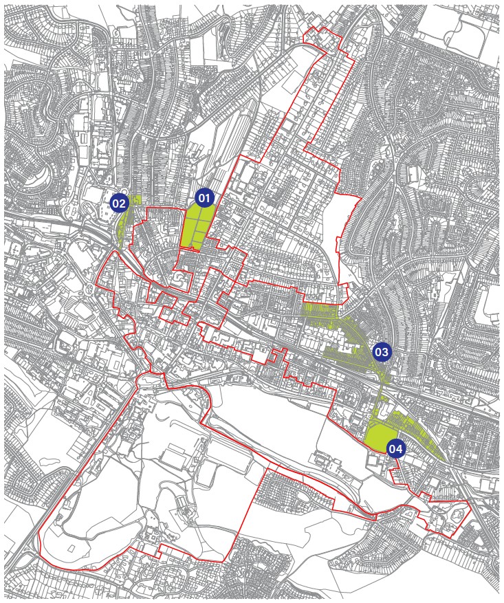
Proposed extensions to the conservation area:
01. the south end of High Wycombe Cemetery
02. Temple End and the former police station
03. Totteridge Avenue and Gordon Road
04. London Road and cricket club
| Page | Response |
|---|---|
| 01. Proposed extension to the conservation area: the south end of High Wycombe Cemetery | 0 of 1 questions answered |
| 02. Proposed extension to the conservation area: Temple End and the former police station | 0 of 1 questions answered |
| 03. Proposed extension to the conservation area: Totteridge Avenue and Gordon Road | 0 of 1 questions answered |
| 04. Proposed extension to the conservation area: London Road and cricket club | 0 of 1 questions answered |
| General comments on the draft appraisal and management plan | 0 of 1 questions answered |
| About you | 0 of 3 questions answered |
| More about you (if you're responding as an individual) | 0 of 5 questions answered |
| About your organisation (if applicable) | 0 of 2 questions answered |